Contact Seller
**POSTPONED** 2640 +/- Acres Decatur & Norton Co., KS
Description
🚨**DECATUR & NORTON CO., SALE HAS BEEN POSTPONED**🚨
Due to inclement weather, the Chambers real estate auction originally scheduled for Wednesday, February 12, 2025, has been postponed.
New Auction Date: Wednesday, February 19, 2025
Location: Gateway Civic Center, 1 Morgan Dr., Oberlin, KS 67749
Time: 1:00 PM
We sincerely apologize for any inconvenience this may cause and appreciate your understanding. We look forward to your participation on the new date.
If you have any questions or concerns, please do not hesitate to reach out.
ALL 9 TRACTS WILL BE SOLD INDIVIDUALLY WITH NO COMBINATIONS
LIVE INTERNET & PHONE BIDDING AVAILABLE
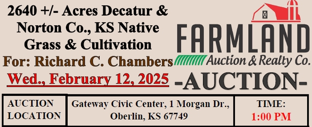
2640 +/- Acres Decatur & Norton Co., KS Native Grass & Cultivation
For: Richard C. Chambers
Wed., February 12, 2025
AUCTION LOCATION
Gateway Civic Center, 1 Morgan Dr., Oberlin, KS 67749
TIME: 1:00 PM
TRACT 1:
LAND LOCATION:
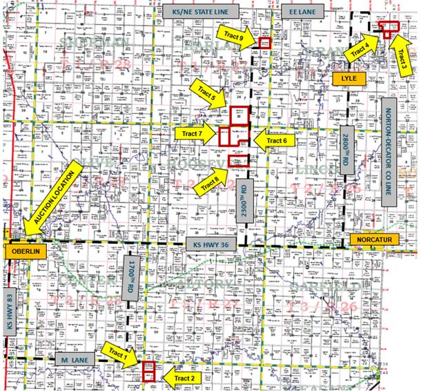
From Oberlin: From Ks Hwy 36 & 83 Int., 6 mi. S to M Lane; 7 mi. E. to NW C; OR 6 mi E to 1700 RD, 6 mi. S to M Lane; 1 mi. E to NW C
From Norcatur: 12 mi W to 1700 Rd; 6 mi. S to M Lane; 1 mi. E to NW C
LEGAL DESCRIPTION:
The Northwest Quarter (NW/4) of Section Six (6), Township Four (4) South, Range Twenty-Seven (27) West of the 6th P.M. Decatur County, Kansas
F.S.A. INFORMATION:
153.24 Acres Cultivation
TRACT 2:
LAND LOCATION:
From Oberlin: From KS Hwy 36 & 83 Int., 6 mi. S to M Lane, 7 mi. E, ½ mi S to NW C; OR 6 mi E to 1700 RD, 6 mi. S to M Lane; 1 mi. E, ½ mi S to NW C
From Norcatur: 12 mi W to 1700 Rd, 6 mi S to M Lane, 1 mi. E, ½ mi S to NW C
LEGAL DESCRIPTION:
The Southwest Quarter (SW/4) of Section Six (6), Township Four (4) South, Range Twenty-Seven (27) West of the 6th P.M. Decatur County, Kansas
F.S.A. INFORMATION:
98.67 Acres Cultivation
55.03 Acres Grassland
TRACT 3:
LAND LOCATION:
From Oberlin: From KS Hwy 36 & 83 Int. 17 mi E to 2800 RD, 12 mi N to EE LN (St Line), 1 mi E, 1 mi S, ¾ mi E to SW C
From Lebanon, NE: 2 mi E to RD 406, 3.5 mi S to KS St Line, 2 mi E to 2700 RD, 1 mi S to DD RD, ¾ mi E to SW C
LEGAL DESCRIPTION:
The North Half (N/2) of the Southeast Quarter (SE/4) and the Southeast Quarter (SE/4) of the Southeast Quarter (SE/4) of Section One (1), Township One (1) South, Range Twenty-Six (26) West of the 6th P.M. Decatur County, Kansas and the Southeast Quarter (SE/4) of Section Six (6), Township One (1) South, Range Twenty-Five (25) West of the 6th P.M. Norton County, Kansas
F.S.A. INFORMATION:
102.84 Acres Cultivation (25.8 Acres Wheat Stubble)
158.24 Acres Grassland
TRACT 4:
LAND LOCATION:
From Oberlin, KS: From KS Hwy 36 & 83 Int. 17 mi E to 2800 RD, 12 mi N to EE LN (St Line), 1 mi E, 1 mi S ¾ mi E to NW C
From Lebanon, NE: 2 mi E to RD 406, 3.5 mi S to KS ST Line, 2 mi E to 2700 RD, 1 mi S to DD RD, ¾ mi E to NW C
LEGAL DESCRIPTION:
The Northeast Quarter (NE/4) of the Northeast Quarter (NE/4) of Section Twelve (12), Township One (1) South, Range Twenty-Six (26) West of the 6th P.M. Decatur County, Kansas
F.S.A. INFORMATION:
25.72 Acres Cultivation (All Wheat Stubble)
13.56 Acres Grass
TRACT 5:
LAND LOCATION:
From Oberlin, KS: From Ks Hwy 36 & 83 Int., 12 mi. E to 2300 RD; 6 mi. N to SE C
From Lebanon, NE: 1 mi W on Hwy 89 to RD 402; 8.5 mi. S to NE C
LEGAL DESCRIPTION:
All of Section Thirty-Five (35), Township One (1) South, Range Twenty-Seven (27) West of the 6th P.M. Decatur County, Kansas
F.S.A. INFORMATION:
222.25 Acres Cultivation (All Wheat Stubble)
403.79 Acres Grassland
TRACT 6:
LAND LOCATION:
From Oberlin, KS: From Ks Hwy 36 & 83 Int., 12 mi. E to 2300 RD; 6 mi. N to NE C
From Lebanon, NE: 1 mi W on Hwy 89 to RD 402; 9.5 mi. S to NE C
LEGAL DESCRIPTION:
The West Half (W/2) and the Northeast Quarter (NE/4) and the North Half (N/2) of the Southeast Quarter (SE/4) of Section Two (2), Township Two (2) South, Range Twenty-Seven (27) West of the 6th P.M. Decatur County, Kansas
F.S.A. INFORMATION:
208.78 Acres Cultivation
340.75 Acres Grassland
TRACT 7:
LAND LOCATION:
From Oberlin, KS: From Ks Hwy 36 & 83 Int., 12 mi E to 2300 RD, 5 mi. N, 1 mi W to SE C
From Lebanon, NE: 1 mi W on Hwy 89 to RD 402; 10.5 mi. S, 1 mi W to SE C
LEGAL DESCRIPTION:
The East Half (E/2) of Section Three (3), Township Two (2) South, Range Twenty-Seven (27) West of the 6th P.M. Decatur County, Kansas
F.S.A. INFORMATION:
124.31 Acres Cultivation
190.32 Acres Grassland
TRACT 8:
LAND LOCATION:
From Oberlin, KS: From Ks Hwy 36 & 83 Int., 12 mi. E to 2300 RD; 4 mi. N to SE C
From Lebanon, NE: 1 mi W on Hwy 89 to RD 402; 11.5 mi. S to NW C
LEGAL DESCRIPTION:
The South Half (S/2) of Section Eleven (11), Township Two (2) South, Range Twenty-Seven (27) West of the 6th P.M. Decatur County, Kansas
F.S.A. INFORMATION:
167.11 Acres Cultivation
147.18 Acres Grassland
TRACT 9:
LAND LOCATION:
From Oberlin, KS: From Ks Hwy 36 & 83 Int., 12 mi. E to 2300 RD; 10 mi. N, ½ mi E to SW C
From Lebanon, NE: 1 mi W on Hwy 89 to RD 402; 5.5 mi. S, ½ mi E to SW C
LEGAL DESCRIPTION:
The Southeast Quarter (SE/4) of Section Twelve (12), Township One (1) South, Range Twenty-Seven (27) West of the 6th P.M. Decatur County, Kansas
F.S.A. INFORMATION:
39.35 Acres Cultivation
118.37 Acres Grassland
GOVERNMENT PROGRAMS & TAXES:
Purchaser to stay in compliance with all US Government Programs the property is presently enrolled in. Government programs to follow current F.S.A. guidelines. The farm is in the PLC program.
2024 Taxes:
Tract 1: $1542.80
Tract 2: $1,048.20
Tract 3: $193.96 2024 Oil Tax: $1,281.42 Oil Severance Tax: $32.12
Tract 4: $299.80
Tract 5: $3,217.36
Tract 6: $3,167.54 Oil Severance Tax: $149.80
Tract 7: $1,940.00 2024 Oil Tax: $898.60 Oil Severance Tax: $85.59
Tract 8: $2,308.52
Tract 9: $689.34
GENERAL INFORMATION:
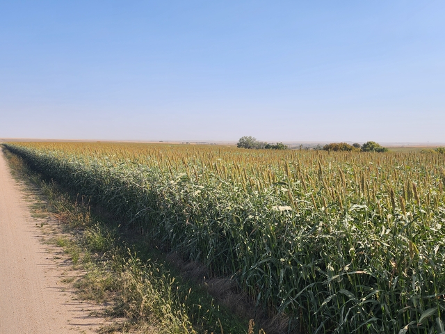
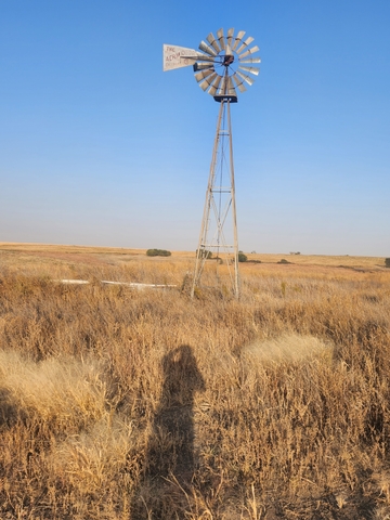
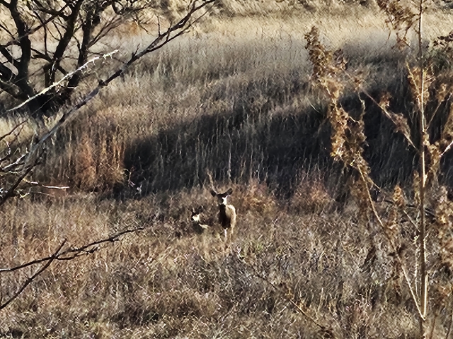
All these tracts are productive cultivation and good native grass watered by windmills and/or earth dams. Tracts 2, 3, and 5 have wells powered by electricity. These tracts also offer excellent large game and upland bird hunting potential.
MINERALS:
All the SELLER’s producing, and non-producing Royalty Interest will convey with the surface.
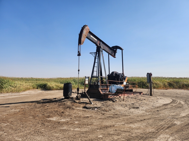
TRACT 3: This tract has 3 producing oil wells, producing from the Lansing/KC formation. There is one well on the O’Hare #1 Lease with a RI of 0.125 and production in 2021-1129 bbls; 2022-756 bbls; 2023-849 bbls; through 9/2024-754 bbls. There are 2 wells on the M.O’Hare Lease, wells 9-1 and 16-1, with a RI of 0.125 and in 2021-309 bbls; 2022-453 bbls; 2023-326 bbls; through 9/2024-213 bbls.
TRACT 7: This tract has 1 producing oil well producing from the Lansing/KC formation. This well being the Macfee #1 with a RI of 0.125 and in 2021 613 bbls; 2022 561 bbls; 2023 593 bbls; through 7/2024 327 bbls.
POSSESSION:
Possession will be at closing on all Tracts. PURCHASER to reimburse Tenants on or before closing for chemical and application of wheat stubble burn down on Tract 3, 4, and 5.
Tracts 3: $980.66, Tract 4: $977.62, Tract 5: $8,434.43.
TERMS: 10% down day of sale, balance to be paid upon title approval and delivery of deed, said closing to be on or before March 28th, 2025, or as soon as title requirement, if any can be corrected. Every effort will be made to honor said original closing date set forth in this contract. Sale is not contingent on the purchaser obtaining financing. Financing, if necessary, needs to be approved prior to the auction. The seller agrees to convey said property by a good and sufficient Trustees Deed to the purchaser, subject to easements restrictions, roads, rights-of-way, leases, reservations, and county zoning regulations of record. Said deed shall be delivered to the purchaser at the time of settlement. Seller(s) to furnish and pay for title insurance showing merchantable title in the Seller. Title Insurance is being prepared by Decatur County Title & Abstract. These tracts are being sold by U.S. Government Survey. If the purchaser feels that an additional survey is needed, the cost shall be the responsibility of the Purchaser.
Listing Agent: Roger Legleiter (785) 623-8717
Agency Disclosure: Farmland Auction & Realty Co., Inc is the agent of the seller. If purchaser desires representation, legal council is advised.
Farmland Auction & Realty Co., Inc.
1390 E. 8th, Unit A
Hays, KS 67601
785-628-2851
E-mail: farmland@farmlandauction.com

